Keeping a modern eye on plant facilities
Efficient management of production and transport of oil and gas requires accurate, timely information about operating assets. Some of the most valuable information includes spatial data, which provides data on the location, condition and status of structures, pipelines and industrial equipment. Already a familiar tool for many engineers and plant operators, spatial data can range from printed 2D maps and schematics to interactive 3D models. But collecting and managing spatial information with sufficient accuracy and detail can be costly. An emerging discipline called ‘industrial geomatics’ (IG) is providing new levels of efficiency and transparency to energy operations.

Processed panoramic images are used to created detailed models. Technicians can extract precise 3D coordinates for any point in the images to determine individual dimensions and clearances. Simple viewing tools make the data available to project teams and clients. Credit: Trimble
Industrial geomatics combines new geospatial technologies with modern information management to support work in plant design and construction, operations and lifecycle management. IG moves beyond traditional industrial surveying by leveraging 3D laser scanning, terrestrial imaging and visualisation tools to deliver visual and empirical data. The combined technologies produce a dense flow of information for design, construction, procurement and project management. By going beyond traditional spatial information of position and description, IG helps operators to answer questions about condition and status of facilities and equipment, how to maintain and repair them, and how to do so safely.
Industrial geomatics enables multiple disciplines to see project conditions in context and from multiple perspectives. IG data can be collected using a variety of technologies, including GNSS and optical surveying, airborne and terrestrial photography and 3D scanning. But for many clients the method for collecting information is unimportant. By the time a project manager sees the results of a survey, the large volume of field data has been condensed into information needed for design and analysis. It’s common for multiple specialties such as environmental, engineering or project management to work off a single data set, extracting similar information for different purposes. By leveraging the ability to have a multi-disciplinary project team work from one database, IG can introduce across-the-board efficiency and cost savings.

A technician uses an imaging rover to collect images and position data on a pipeline weld prior to trenching and backfill. High-resolution photos capture inspection data inked onto the pipe. A GNSS receiver integrated on the top of the imaging rover provides centimeter-level georeferencing. Credit: Trimble
For many applications 3D laser scanning is the tool of choice to gather data on complex facilities. The combination of point cloud data and sophisticated 3D modelling software provide good results in industrial settings. However, a new approach has emerged to collect and manage spatial data on large, complex projects. Working with the Trimble® V10 imaging rover, which combines surveying and terrestrial close-range photogrammetry, crews are able to collect georeferenced 360° panoramic images in a few seconds. By collecting multiple panoramic images on a site, a field technician can capture information to provide complete visual and empirical documentation of the site’s features and conditions.
The imaging rover can be used as a stand-alone solution or to enhance lidar or traditional survey data. Data from imaging rovers can readily be combined with 3D point clouds, photographs and conventional survey data to produce comprehensive datasets. For example, when working on facility scanning projects, crews can place the imaging rover into confined or obstructed areas to capture details not visible from the scanner. The images can be tied into the point cloud without the need for additional scanning targets. In addition to saving the time needed for an additional scan setup, the approach provides images that specialised software can drape over point clouds to produce photorealistic 3D models.
Imaging rovers are also used in pipeline planning and construction. Survey crews can capture photos in areas such as road crossing or locations where conditions might require the pipeline to avoid utilities or other structures. Engineers can use the panoramic images to ‘see’ the site from multiple viewpoints and develop appropriate designs. On long-distance projects, imagery can be used to develop additional points and site information without incurring costs to send crews back to collect the additional data.
During pipeline construction, inspection crews capture as-built information including top of pipe measurements and documentation on welds and other construction processes. By integrating a V10 imaging rover with real-time GNSS positioning, a team can capture locations and panoramic images of the weld points in seconds. Additional images can be captured using a rugged tablet computer. The positions, photos and panoramic images are then processed and stored in a spatial database to provide a record of the pipeline excavation and pre-backfill conditions.
Imaging rovers will play an increasing role in IG because the solution provides three important advantages. First, imaging rovers reduce the time needed for on-site data collection and can eliminate the need for return visits to capture missed or additional information. Second, imagery freezes a site in time, which enables teams to see surrounding conditions, resolve questions and support quality control and environmental concerns. The third benefit is safety. Imaging can remove the need to enter hazardous areas and support planning on activities that prevent accidents. Spatial data also helps plant operators to plan precisely and execute repairs and retrofits.
The role of industrial geomatics continues to expand in the oil and gas industry. The emerging technologies for measurement, modelling and visualisation provide information that is timely, accurate and easily shared among large project teams.
John Stenmark, LS, is a writer and consultant working in the AEC and technical industries. He has more than 25 years of experience in applying advanced technology to surveying and related disciplines.
Read the article online at: https://www.oilfieldtechnology.com/digital-oilfield/20042016/keeping-a-modern-eye-on-plant-facilities-594/
You might also like
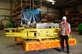
Decom Engineering surpasses annual target as global demand drives record growth
Decom Engineering (Decom) has secured contracts worth an estimated £4.5 million during the first half of 2026, surpassing its original full-year target and positioning the Aberdeen-based engineering specialist to drive forward to a record annual revenue of £6 million.